Wednesday, March 31, 2010
Monday, March 22, 2010
WEEK 9 LAB: VECTOR ANALYSIS

Q1: Which tool did you use? Was there any noticeable difference between its results and the results from the instructions?
I used the Intersect tool. There were no noticeable differences between the results.
Q2: Which tool did you use here? Why?
I used the Erase tool, because it creates a feature class outside of the erase feature class, in this case outside of the conservation areas.
Q3: How many features are in this layer? What is the area of the largest feature? What is the area of the smallest feature?
There were 79 features in this layer. The area of the largest feature was 776 503 square meters, while the area of the smallest feature was 748 square meters.
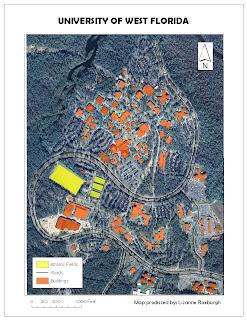
I enjoyed this lab, and used a png format for the image of the map, instead of jpeg. The file size was a lot smaller at a higher resolution. So I'd consider using this format in future for posting maps to the blog.
Tuesday, March 2, 2010
Subscribe to:
Comments (Atom)
