Wow, this has been quite some lab!! And judging by the discussion posts, I am not the only one who thinks so. I have learnt a lot though and its been a good revision of what we have learnt so far.
MAP 1. RASTER DATASETS
MAP 2. INVASIVE PLANTS AND STRATEGIC HABITAT CONSERVATION AREAS

MAP 1. RASTER DATASETS

MAP 2. INVASIVE PLANTS AND STRATEGIC HABITAT CONSERVATION AREAS

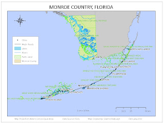
MAP 3. PUBLIC LANDS, HYDROGRAPHY, ROADS AND CITIES

I was excited about the fact that I was doing Monroe County, the Everglades State. But it was challenging to try to represent the public lands and the hydrographic features, since much of the state seems to be under water and public land. The Keys were particularly challenging since they are so small relative to the mainland, but also very long for an inset map. Hopefully with more experience I will learn how to do a better job.
No comments:
Post a Comment